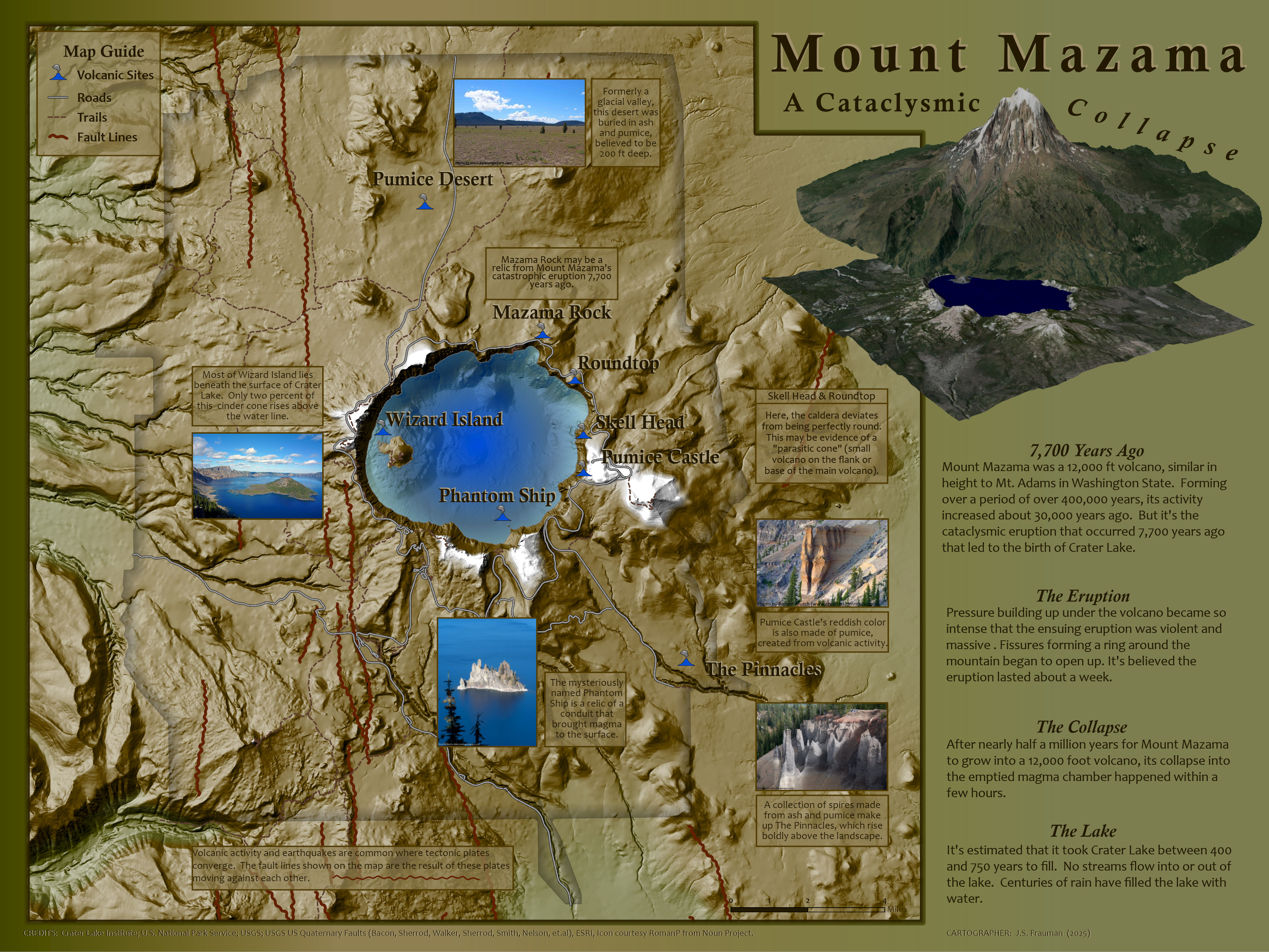
Recognized at the ESRI User Conference 2025 as a finalist in the Place Perspective category, this "Mount Mazama" map uses cartographic blending techniques (courtesy of Esri cartographer John Nelson's valuable insight), custom points, and several data layers to illustrate the geologic history of Crater Lake, Oregon.
The digital elevation model came from USGS TNM Download (v2.0), fault line data from US Quaternary Faults, and landmarks from the National Park Service. All work was done using ArcGIS Pro.
Crater Lake lies in the caldera of Mount Mazama, one of several volcanoes that dot the Cascade Range of the Pacific Northwest. Two tectonic plates converge here, the Juan de Fuca Plate and the North American Plate. Numerous fault lines, shown in dark red on the map, are the result of the Juan de Fuca Plate pushing its way under the North American Plate. This map identifies the locations where the remnants of Mount Mazama and its massive eruption can be found within the park boundaries.
Crater Lake is the deepest lake in the United States, formed from the eruption and subsequent collapse of Mount Mazama 7700 years ago. Centuries of rain and snowmelt filled the resulting caldera with crystalline, lapis blue waters, making Crater Lake one of the most dramatic and beautiful geologic landmarks in the US.
Image credits in Map: Attributions are shown in each photo. More geology images from Marli B. Miller are at Geologic Time Pics.