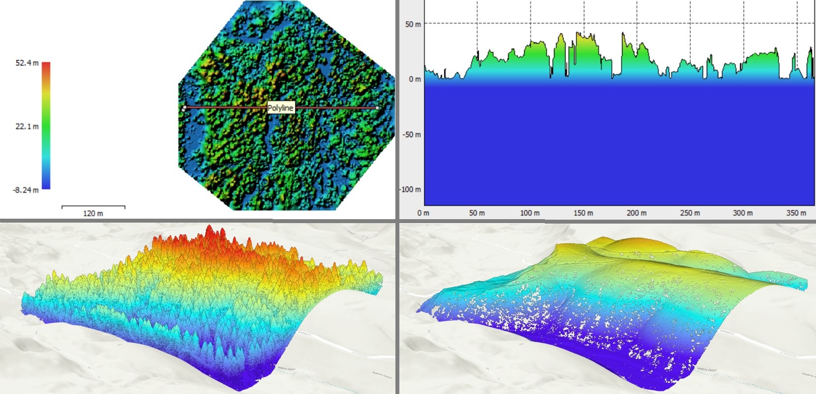
Drone photogrammetry of a forest shown after processing using Agisoft. Polyline in lefthand used to create graph showing tree heights. 3D images of same forest using lidar data, then processed using ArcGIS Pro. Credits: J. Frauman, processed imagery; LiDAR Image: USGS, 20250515, USGS 1/3 Arc Second n40w121 20250514: U.S. Geological Survey; Forest Image sourced from Open Forest Observatory.
What We Do
Service Examples
- Site Suitability
- Find optimal locations based on terrain, demographics or frequency of incidents
- Select locations for wildlife crossings that will provide the greatest benefit to wildlife and drivers
- Evaluate the likelihood of finding particular species based on vegetation, water, aspect, slope, and/or elevation
- Network Analysis
- Plan delivery routes to improve efficiency or reduce greenhouse gas emissions
- Ascertain where emergency vehicles can find alternate routes when roads are blocked by trains
- Remote Sensing
- Analyze the impact of forestry on wildlife corridors
- Assess the extent of a wildfire burn area or the status of its recovery using NDVI (normalized difference vegetation index)
- Explore issues of environmental justice such as urban tree coverage based on population demographics
- Analyze current land use or land use changes over time
- Spatial Statistics
- Show statistically significant clusters of incidents or conditions using hot spot analysis
- Assess changes by location and over time using spatiotemporal analysis
- Interactive Map Design
- Dashboards linked to near real-time satellite data can monitor and report on conditions
- StoryMaps communicate complex information to stakeholders or the public and can be used to advocate for change or improve decision-making
- Cartography
- Whether a map is in 2D or 3D, cartographic techniques can elevate maps both visually and viscerally
- Data Wrangling
- Ensure data is well prepared and ready for mapping
- Documentation and Templates
- Projects that are likely to be repeated need clear instructions or be programmed using ArcPy to expedite and aid in future use
Pricing
Due to the wide range in size, complexity of projects and output desired (prints or files), costs will vary. Pricing is established before an agreement is made. Should the project scope change, any pricing change will be agreed upon beforehand.
Reach Out
Contact info@geospatialoe.space to set up a free 30 minute consultation to discuss your needs.